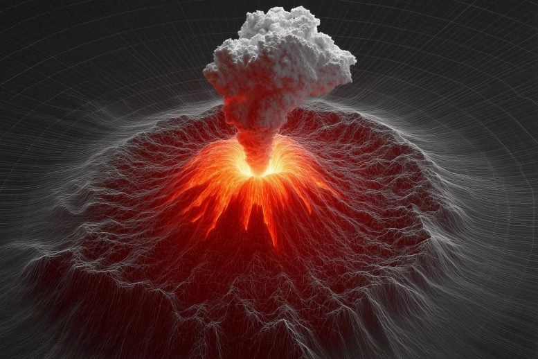
 Anak Krakataus deadly 2018 collapse was preceded by years of unnoticed ground movement, now exposed through satellite radar analysis. Researchers believe such data could offer crucial early warnings for similar volcanic threats worldwide. Credit: SciTechDaily.com
In 2018, the Anak Krakatau volcano in Indonesia collapsed catastrophically, generating a deadly tsunami.
Now, researchers reveal that the volcanos flank had been slowly slipping for yearsan invisible danger detectable through satellite radar long before disaster struck.
Silent Slippage Before Disaster
In 2018, a massive eruption caused the southwest flank of Indonesias Anak Krakatau volcano to collapse into the sea, triggering a devastating tsunami that struck nearby islands. The disaster killed over 400 people and injured thousands more across Java and Sumatra.
Now, a new study by researchers at Penn State reveals that the mountainside had been slowly shifting for years before the collapse and that movement significantly accelerated in the months leading up to the eruption. Their findings, recently published in Geophysical Research Letters, suggest the tragedy might have been predicted with the right monitoring tools.
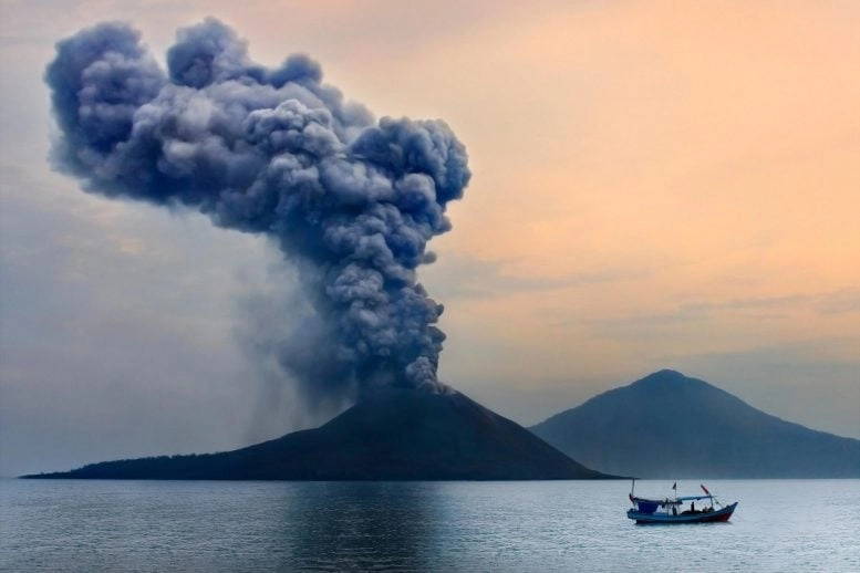 The 2018 eruption of Anak Krakatau unleashed a catastrophic chain of events as the volcanos flank collapsed into the sea, creating a tsunami that slammed into coastal communities with devastating force. Over 400 lives were lost in one of Indonesias deadliest recent natural disasters.
No Warning for a Deadly Collapse
Ocean volcanoes, when they are unstable, can collapse catastrophically and generate a tsunami, said Christelle Wauthier, associate professor of geosciences at Penn State and co-author of the study. And when that happened in 2018, more than 400 people died because nobody had instruments on the ground to know potentially if there was acceleration or change in the deformation behavior. Nobody knew the collapse was imminent. This study shows, unfortunately retrospectively, that we could forecast it if we had this remote sensing data set to get the surface deformation.
To uncover the signs of instability, the team used a technique called Interferometric Synthetic Aperture Radar (InSAR) a remote sensing method that uses radar satellites to detect tiny changes in the Earths surface, often just a few inches.
The researchers analyzed more than 10 years of satellite data from ALOS-1, COSMO-SkyMED, and Sentinel-1, mapping ground deformation on Anak Krakatau in the years before the 2018 disaster. Their results revealed long-term slippage along a fault on the volcanos flank, punctuated by clear periods of acceleration before the collapse.
Creeping Toward Collapse
Overall, the detachment fault experienced approximately 15 meters (roughly 50 feet) of slip from 2006 to 2018 with acceleration and deceleration periods, and a notable acceleration prior to the 2018 collapse, said Young Cheol Kim, a doctoral candidate at Penn State and lead author of the study.
While the InSAR technique is not novel, it is rare to analyze such a large amount of data, the scientists said. The work required access to the high-performance Roar computer cluster managed by the Penn State Institute for Computational and Data Sciences (ICDS).
Integrating hundreds of radar images requires a great deal of computational power, said Wauthier, who is also associate director and a co-hire in ICDS. Its a lot of data storage and data processing and it takes some time and resources.
Promise of Real-Time Volcano Monitoring
Still, the technique may show promise for near-real-time monitoring of active ocean volcanoes, especially in locations where other monitoring is not available, the scientists said.
Slip occurs when there is a weakness or fault under a volcano. The volcano grows larger as it erupts over time, and eventually it reaches a threshold where there is too much weight for the fault to support, leading to a collapse.
This process may start like a slow landslide over years, Wauthier said, but when it begins to accelerate it can be a sign that collapse is imminent.
Acceleration as a Red Flag
The whole chunk of the volcano that collapsed was already moving like a slow landslide, said Wauthier, who is Kims adviser. And, so, its very important to be able to look at the temporal evolution of that deformation, because if you have an acceleration, it can lead to a collapse. Our data shows that, basically, there was a precursor to the collapse.
The researchers said that other ways to track deformation, like ground-based GPS instruments are often lacking in locations like Anak Krakatau. Because it is an active volcano, there are safety and permitting issues. Ground-based equipment is costly to deploy and maintain and funding is not always available.
InSARs Role in Future Warnings
If you have a sudden acceleration of slip, it might be the sign that you will have a collapse happening, Wauthier said. Whether its this volcano or others susceptible to collapse worldwide, if you dont have ground-based data in real time, maybe having near-real-time InSAR processing can help researchers be on the lookout for any significant acceleration in slip.
Reference: Satellite Geodesy Uncovers 15 m of Slip on a Detachment Fault Prior to the 2018 Collapse at Anak Krakatau, Indonesia by Young Cheol Kim, Christelle Wauthier and Thomas R. Walter, 16 November 2024, Geophysical Research Letters.
DOI: 10.1029/2024GL112296
Thomas R. Walter, professor at the GFZ German Research Centre for Geosciences, also contributed to this work.
NASA, the U.S. National Science Foundation and the Federal Ministry of Education and Research of Germany supported researchers involved in this project.
Never miss a breakthrough: Join the SciTechDaily newsletter.